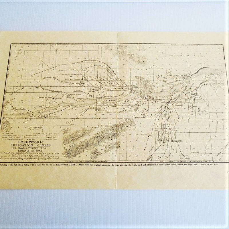
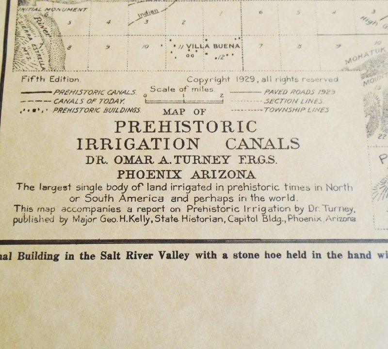
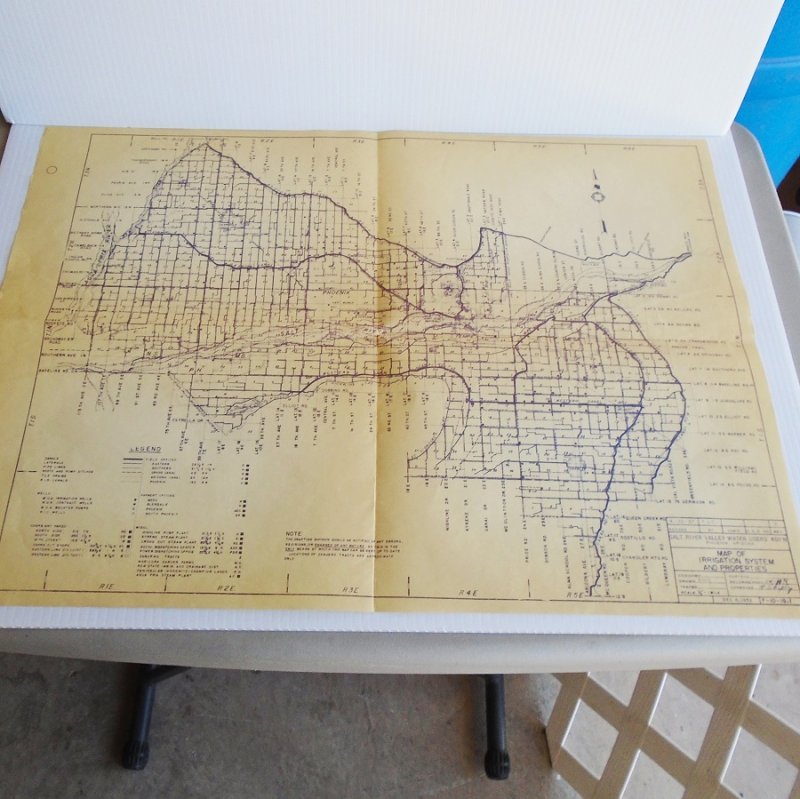
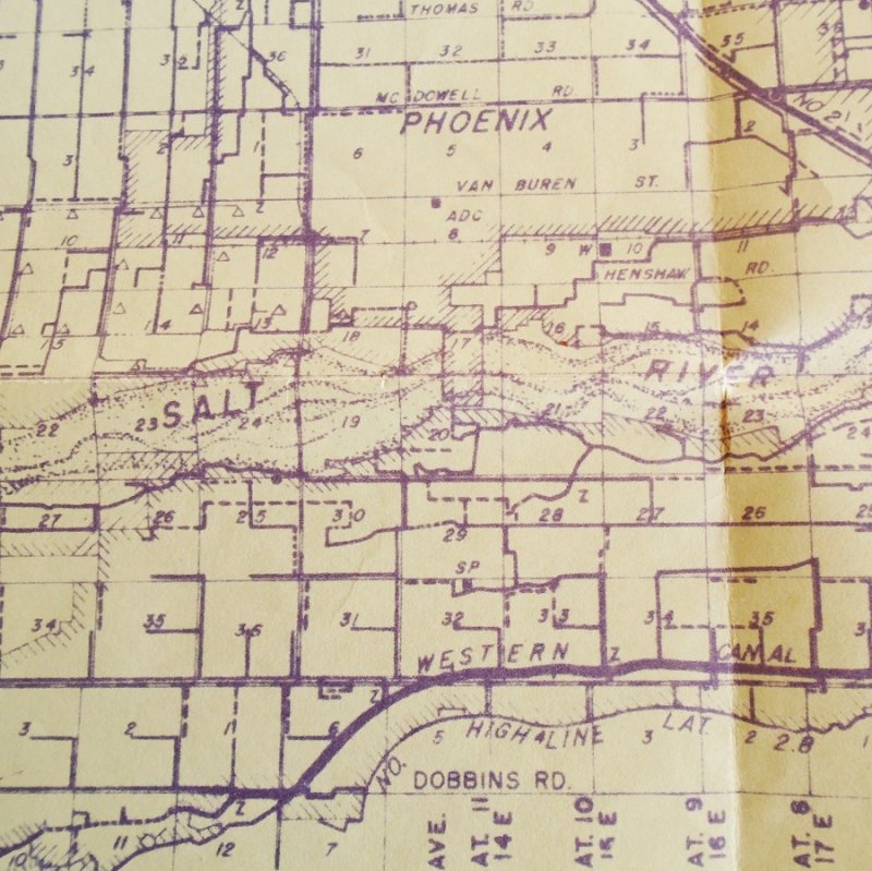
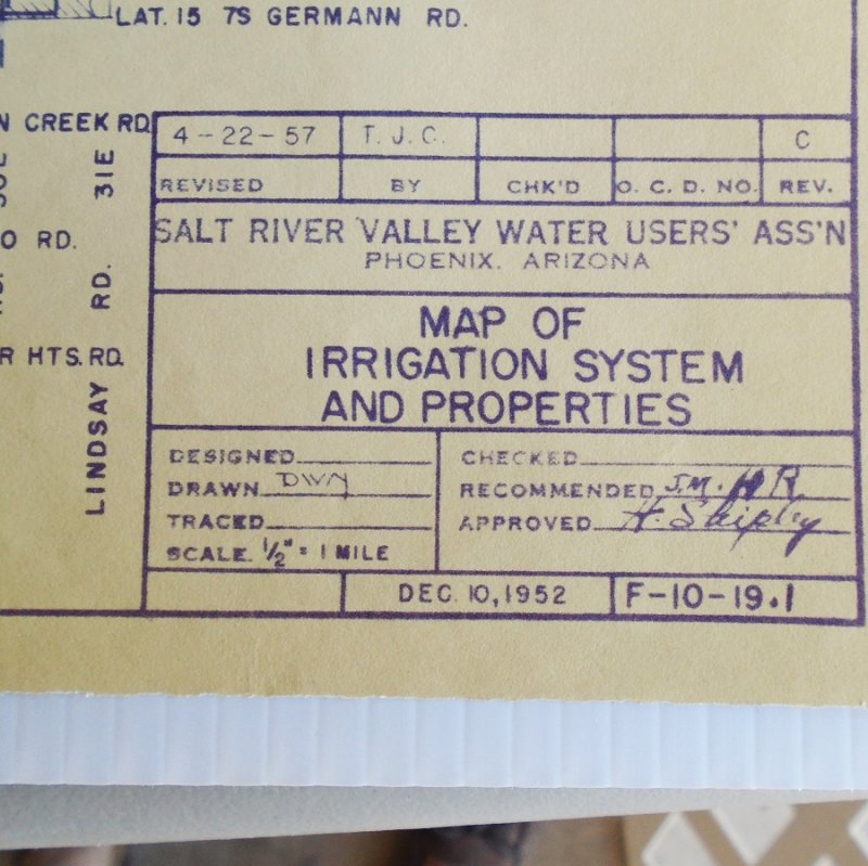
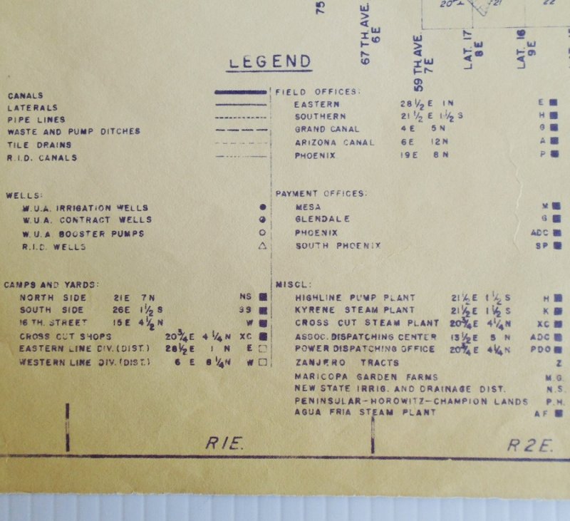
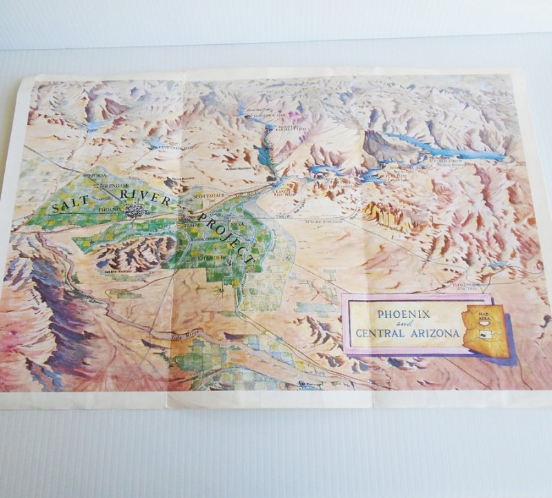
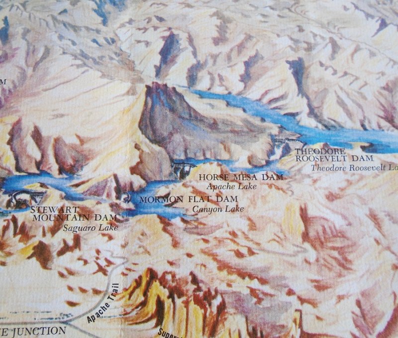
Phoenix Salt River Project map
Map 1 Phoenix Arizona Salt River Project vintage maps. 4 maps dated 1929, 1952, 1960s, and 2000. All excellent condition and ready to frame
Phoenix Salt River Project map
Map 1 Phoenix Arizona Salt River Project vintage maps. 4 maps dated 1929, 1952, 1960s, and 2000. All excellent condition and ready to frame
Phoenix Salt River Project map
Map 1 Phoenix Arizona Salt River Project vintage maps. 4 maps dated 1929, 1952, 1960s, and 2000. All excellent condition and ready to frame
Phoenix Salt River Project map
Map 2 Phoenix Arizona Salt River Project vintage maps. 4 maps dated 1929, 1952, 1960s, and 2000. All excellent condition and ready to frame
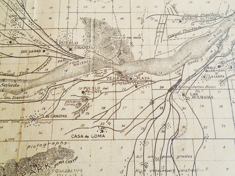
Phoenix Salt River Project map
Map 3 Phoenix Arizona Salt River Project vintage maps. 4 maps dated 1929, 1952, 1960s, and 2000. All excellent condition and ready to frame
Phoenix Salt River Project map
Map 3 Phoenix Arizona Salt River Project vintage maps. 4 maps dated 1929, 1952, 1960s, and 2000. All excellent condition and ready to frame
Phoenix Salt River Project map
Map 3 Phoenix Arizona Salt River Project vintage maps. 4 maps dated 1929, 1952, 1960s, and 2000. All excellent condition and ready to frame
Phoenix Salt River Project map
Map 3 Phoenix Arizona Salt River Project vintage maps. 4 maps dated 1929, 1952, 1960s, and 2000. All excellent condition and ready to frame
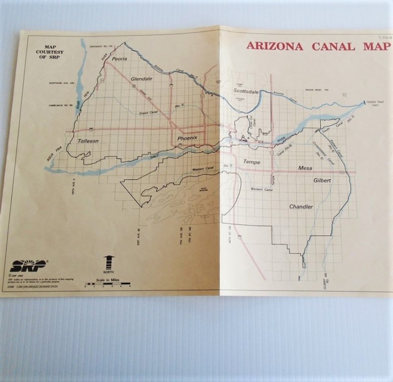
Phoenix Salt River Project map
Map 4 Phoenix Arizona Salt River Project vintage maps. 4 maps dated 1929, 1952, 1960s, and 2000. All excellent condition and ready to frame
Phoenix Salt River Project map
Map 4 Phoenix Arizona Salt River Project vintage maps. 4 maps dated 1929, 1952, 1960s, and 2000. All excellent condition and ready to frame